On a regular base we book with you in behalf of our clients. On december 21, 2016 you did a Cebu City tour for Mr and Mrs Pekel and this couple called us today because they really were very satisfied....
Me and my family had a wonderful experience to Simala thanks to your Guide Flor and the driver, they have been very friendly, hospitable, helpful and very knowlegeable on the tour to Simala....
Just got back home this morning. Thank you for all your assistance in our vacation in Cebu. Your tour was a great service, and very nice tours. The Bohol tour was great, except for the bad weather....
I just came back from Mactan and seating in front of my computer 🙂 I just want to say that we had wonderful days in Mactan and Bohol. Please say thanks to Flor, Jiffy, Edwin, the captain and two crew....
Our family came back to Korea yesterday. I really appreciate for your help. It was a wonderful and perfect family trip for us. We've really enjoyed your hopping tour program. It was fantastic....
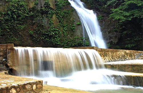
Just want to let you know that we had a wonderful and enjoyable trip in Cebu. We really liked the 5 nights / 6days package. Bohol and Kawasan waterfall trip was great. These two places are really...
Hi ester, the trip especially the snokelling part was worthwhile. The local guide, Ann was a sweet and cheerful individual who kept us entertained throughout the trip with her stories. She is an asset....
“The 6 days Cebu/ Bohol tour was great and the tour guides, drivers, activities, hotels (especially Crimson Resort)…….. were really nice. All transfers were done on time and the guides were very friendly....
We would have wanted to personally thank you for the excellent service that you have rendered during our stay in Cebu but there’s no sufficient time to visit your office. Jess and Kuya Jay both....
Good morning, I`d like to say a big thank you for the last 2 days. You made my stay in Cebu unforgetable! You provided me first class service, I really enjoyed my tours. If anybody asks me for advice....
Good morning, We would like to thank you for yesterday's tour. The staff was very helpful; the tour guide was well informed and had very good english pronounciation and the drivers were very polite.....
KR Travel, We had a spectacular time.. the service KR Travel extended to us are HIGHLY RECOMMENDED...I am already spreading the word to everyone. The tour guides were very professional, knowledgeable....
Thank you so much for the best tour that we had with your company. We got our money's worth. All your staffs, starting from my booking up to the last day of our tour, are very nice and accomodating....
I am back in California after my whirlwind trip to the Philippines. I would like to thank you for arranging my schedule during my visit to your city. The twin city tour was very nice. Ann did a wonderful....
Beth and I would like to complement everyone on the splendid job you all did in organising and running the tour we had the privilege in taking. It would be unfair to single out anyone in particular....
Thanks for all the efficient tour arrangement. The timing of all your guides were very punctual and the cars used for transportation were in good condition. The whole tour we were happy with the whole....
We truly enjoyed our Bohol and Cebu tours. Both Connie and Lex are highly qualified tour guides and were very accommodating. The drivers and Anne were very courteous and helpful. I will definitely refer....
I just would like to send this note to you and, perhaps, please pass it onto your colleagues, Ann and Amy, for their great hospitality and the Bohol tour. Although, it was tiring to begin the tour 5am in....
I would like to tell you that we had a great time in our stay in cebu. The tour is good as well as our assigned tour guides. Ms beth is very informative and helpful, and ms anne also....
I wanted to enter for your readers my personal referral.For any one that would wish to tour Philippines and anywhere, use KR Travel &Tours service, my astonishment at the swiftness and precise way....
Our vacation was very nice. Stay in Plantation Bay is great and our Bohol trip is excellent. The way the trip was set is exactly what we expect. Pick up from hotel is on time, the trip in Bohol....
We had really great and joyful time in Cebu, thanks to you and your company. I really appreciate all your kindness! I and all my other 14 Japanese friends are so satisfied with both Bohol Tour & Island....


