Leyte Travel Guide and Itinerary – Leyte is most famous for its role in the reconquest of the Philippines in World War II. On 20 October 1944, General Douglas MacArthur waded ashore on Leyte, saying, “I have returned”, but the Japanese did not give up so easily, as the ensuing Battle of Leyte proved. The convergence of naval forces resulted in the four-day Battle of Leyte Gulf, the largest naval battle in history. Leyte (/ˈleɪti, ˈleɪteɪ/ LAY-tee, LAY-tay) is an island in the Visayas group of islands in the Philippines. It is eighth-largest and sixth-most populous island in the Philippines, with a total population of 2,626,970 as of 2020 census.
Since the accessibility of land has been depleted, Leyte has provided countless number of migrants to Mindanao. Most inhabitants are farmers. Fishing is a supplementary activity. Rice and corn (maize) are the main food crops; cash crops include coconuts, abaca, tobacco, bananas, and sugarcane. There are some manganese deposits, and sandstone and limestone are quarried in the northwest. Politically, the island is divided into two provinces: (Northern) Leyte and Southern Leyte. Territorially, Southern Leyte includes the island of Panaon to its south. To the north of Leyte is the island province of Biliran, a former sub-province of Leyte.
The major cities of Leyte are Tacloban, on the eastern shore at the northwest corner of Leyte Gulf, and Ormoc, on the west coast.
Leyte today is notable for the geothermal electric power plants near Ormoc. The Leyte provincial capitol is the seat of the provincial government where there is a mural depicting the First Mass in the Philippines, believed to have happened in Limasawa, and the landing of General Douglas MacArthur. The MacArthur Landing Memorial National Park in Red Beach, Palo, marks the 1944 landing by the American liberation forces. It also has a lagoon where a life-sized statue of Gen. MacArthur stands.
Mahagnao Volcano Natural Park Located in Burauen, Leyte, about 66 km (41 mi) from Tacloban City, the Mahagnao Volcano Natural Park attracts visitors with its lakes, craters, hot springs, multi-colored mud, virgin forests and lagoon. It was proclaimed as a national park in 1937. Like other regions in the Philippines, the area enjoys a temperate climate. It has an elevation of 1,200 meters above sea level and an area of 635 hectares, within the boundaries of Burauen, La Paz and McArthur towns. Lake Danao is a violin-shaped lake hemmed by cloud-capped mountain ranges.
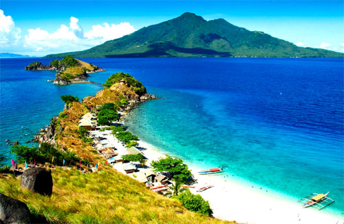
Kalanggaman Island in Palompon, Leyte is a virgin island with pure white sand. The ecological atmosphere of the island had been preserved by the municipality.


